
The Whangawehi walkway also named Te Aratia Walkway was started in December 2020. The project was led by the Whangawehi Catchment Management Group, a community initiative including Marae, landowners and agencies whose focus is to protect the Whangawehi stream. Since 2014, 250 000 native trees have been planted in the catchment, 150 ha of riparian margins retired and 30 ha of bush blocks protected. The group also carries out pest control and engages with the local school.
The idea of developing a walkway over private land came from a desire to share the benefits of such a large scale restoration project with the wider community.
From an Heritage view point, there were once several Maori settlements in the valley which was part of a traditional route across the Peninsula. The Whangawehi river was and still is a source of abundant fish and the fertile river terraces were used to grow crops. Interpretative signs placed along the way will explain some of these stories.
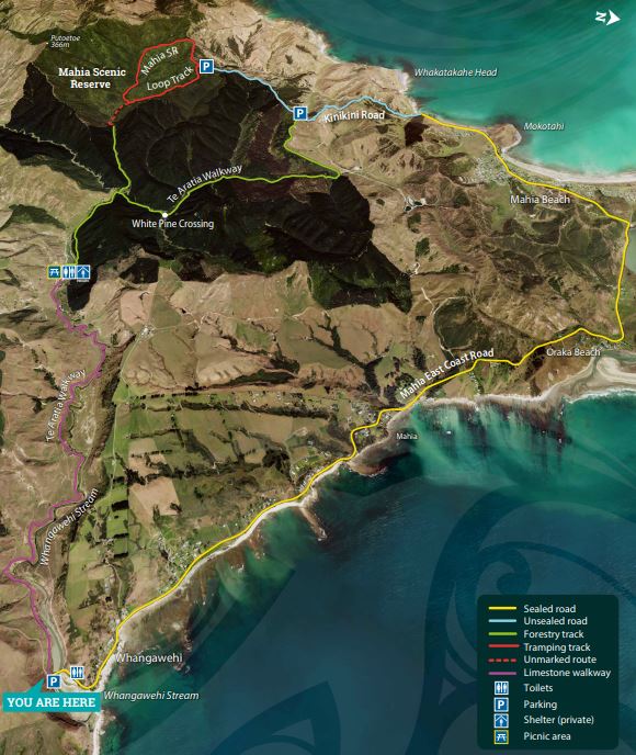
The track offers a number of tramping and cycling possibilities, see the map and the sign for some brief descriptions.
Key indicative distances :
Whangawehi boat ramp to the hut : 6 km
Hut to the Kinikini car park : 6 km
Full loop by Whangawehi boat ramp- Mahia beach – Oraka- Whangawehi boat ramp : 24 km
Current status : the track is closed due to lambing season. It will be reopened after the 23d of September 2023.
